Reducing Flood Risk in Java
Sim Reaney and Simon Mathias, Durham University
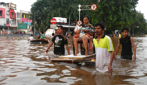
The risk pose by flooding in Indonesia is significant, with many communities experiencing multiple flood events each year, leading to multiple impacts including physical damage, economic loss, displacement and mental health issues. Within the last ten years, there have been 84 significant flood events in Indonesia that have caused 5.3 billion USD of damage, effecting 3m people, and 1498 people have been killed. If we consider Jakarta alone, then the impacts from fluvial flooding alone are estimated to cost USD 321 million per year.

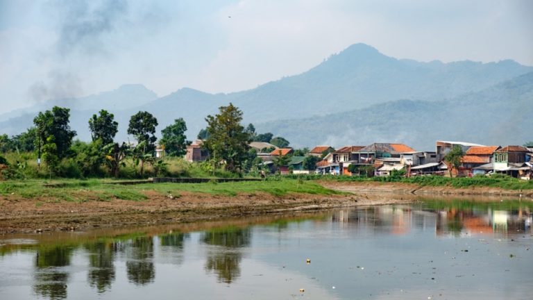
We are working with the local stakeholder, including the Institute Technology Bandung and the local community flood action group to understand their problems, what work has already been undertaken and how Durham science can contribute to this problem. We have been working together with workshops, field visits and training events. We are also installing some hydro- meteorological monitoring equipment and looking into the wider issues within the catchment related to water quality. The catchment has the reputation as being the most water polluted in the world with agricultural, industrial and microbial pollution issues.
In July 2018 we are working closely with ITB to install a new set of hydrological and meteorological monitoring equipment within two catchments. This equipment will record and upload to the web the current river levels, rainfall, solar radiation and wind speeds for multiple locations in the catchments to give near live data. This new equipment will have an instant benefit to reduce flood risk with communities as it will replace the current unreliable setups with a new system. This equipment also provides the foundation for future research collaboration with researchers in Java as the data can feed into many projects and will provide the part of the data feed into a new flood warning system.

We will use the data stream to apply detailed simulation models to the catchments which represent the movement of water through the landscape and into the rivers. For example, they represent how the water may enter the soil and how fast it can move. These models allow us to simulate different possible future climates and test how well different mitigation options to reduce the flood risk. By using detailed topographic data we can also show, at the scale of individual houses, where may be flooded in response to a storm and the timing of the event.
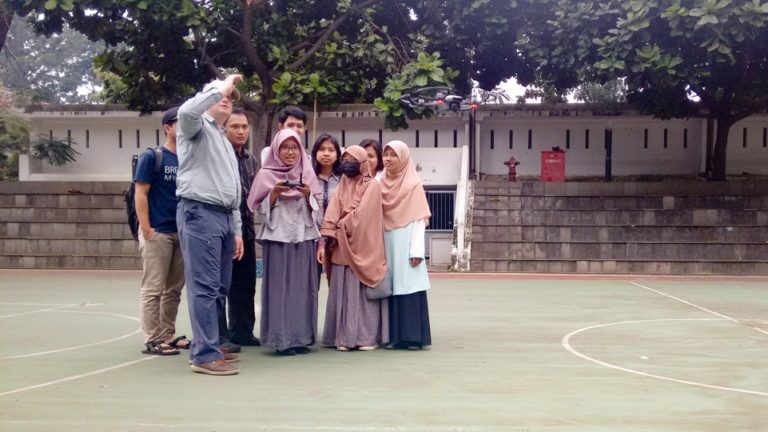
For the detailed flood modelling, one of the key missing dataset for many communities is the detailed topographical data required to drive the flood inundation models. One method that we use to do survey the topography is through the use of drone mapping. On the last trip to Java, we trained about 30 people from the university, community flood action group and others in the region on this approach. This training covered the background and theory of the method, a practical hands on with a small drone and the processing of the images into a topographic dataset. We hope that longer term, the local community will be able to undertake their own floodplain mapping to feed into the flood inundation models and hence give them a greater ownership of the data and flood hazard knowledge base.

The longer term vision for this project is to develop an effective early warning system that can make effective use of data collection, simulation models, weather forecast products, geospatial analysis and community engagement. This can then be a system that can be exported to different catchments and communities which are currently experiences flood risks. We are working with robust but lower cost sensors and data communication approaches to ensure long term sustainability of the developed system. We are also training scientists in Indonesia on new approaches to ensure that they can own the developed system.
